Days of rain covered Coachella Valley in mud, but the clouds broke in time for a Christmas morning hike at the La Quinta Cove trailhead. Out in the misty distance is the Salton Sea.


HDR Photography
Days of rain covered Coachella Valley in mud, but the clouds broke in time for a Christmas morning hike at the La Quinta Cove trailhead. Out in the misty distance is the Salton Sea.
From one Mohonk framing to another, we arrive one of Mohonk’s signature gazebos (but during the day this time.) After a gentle hike, a charming view is a perfect way to cap off the summer season.

Mohonk’s gazebos are iconic, but in my childhood, they vanished into the woods as night fell. The addition of strings of lights to them means that they stand out more without the sunlight.

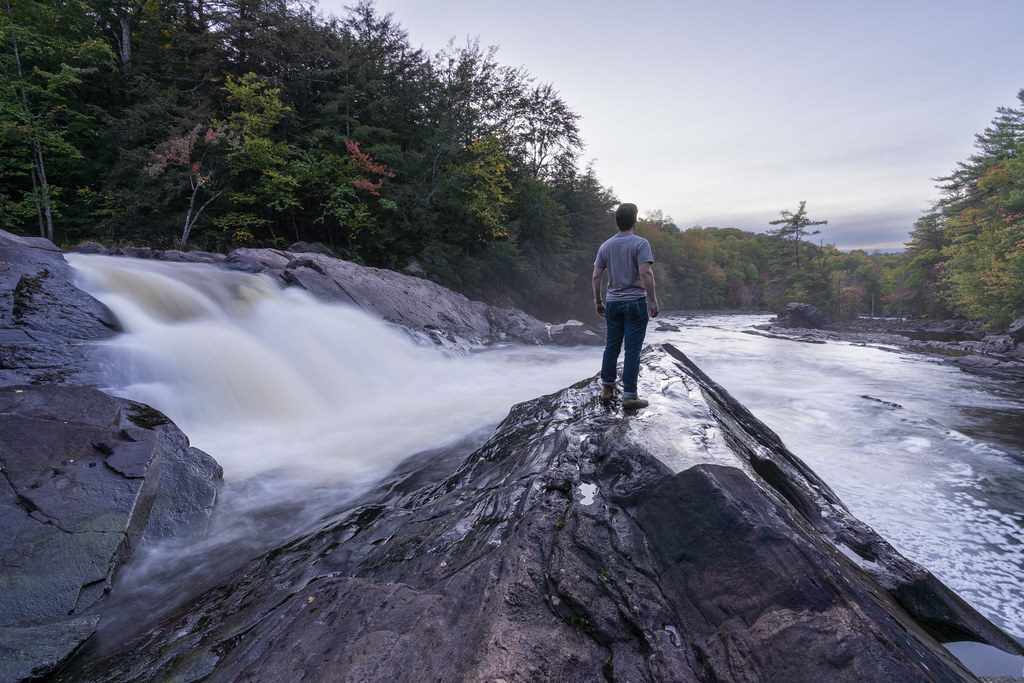
Though there’s chaos in the turbulent flows of rapids through Stone Valley, I like the rhythm in the repeated lengthscale between crests. The long exposure smooths out the water, but the trees remain sharp and spiky.

After a teaser from the climb up on Friday, here is the full view from the top of Mohonk’s Skytop. This high-resolution panorama is definitely worth clicking through to Flickr for the full-sized version. There’s a lot here: the hotel and its namesake lake, but also the trails and conserved forest space around it. The water retention pond in the foreground is the semi-secret reason for Mohonk’s continued existence: though there were a variety of all-wood structures like Mohonk in the past, most have burned down over the years. This is the water source for the Mountain House’s fire suppression system, which was installed early and has preserved the structure through tribulations.

On the path to Mohonk’s Skytop, this gazebo hangs into empty space. The Bob-Rossian layers to this image make the uncanny perch even more dramatic.

Rain brings spontaneous desert symmetry breaking: some areas become rivers and streams, while others stay high and dry. La Quinta Cove brings hiking trails into this equation. Looking high over the landscape, those trails and dry streambeds may be hard to distinguish—until the rain comes. In the distance, just above the tan tanks on the left of the image, the Salton Sea serves as a reminder of how water and the desert interact.

The path at right is a fairly treacherous, dusty way up to the top of this hill; it’s the one I took last year to capture images like this one. Flying to the top with my drone is, by comparison, a bit less strenuous.

Like a child’s legos, spilled out onto the floor until they reach the wall of the room, the sprawl of Coachella Valley reaches from one mountain range to the other.
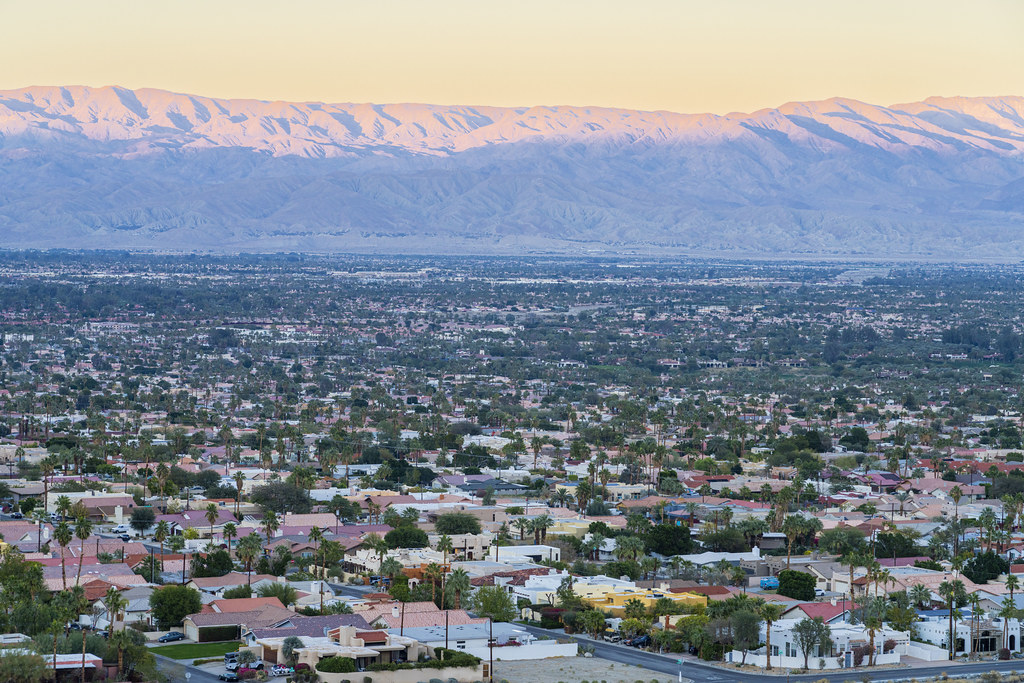
Of course, when that sprawl does reach the edge, modern California’s land conservation kicks in and a hard barrier appears between homes and desert.

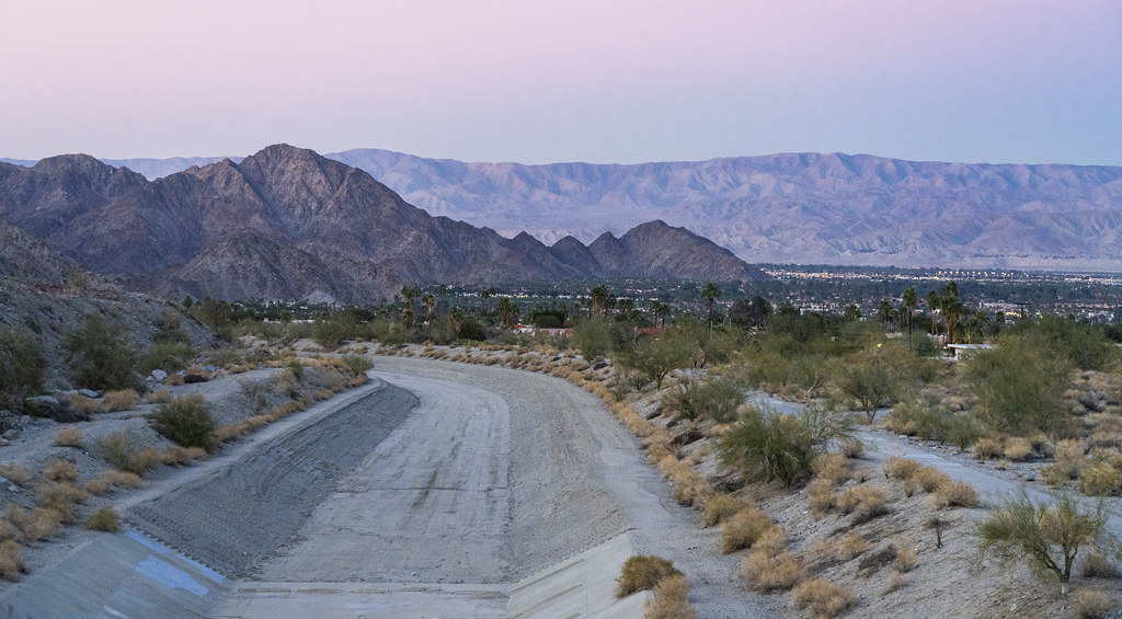
Making it up to a good view in time to catch some sunset colors is great in any area, of course, but the open nature of desert landscapes means that at least I won’t miss the colors if I don’t make it all the way there.

A hike through La Quinta Cove, like many hikes, is a mix of experiencing natural and human-adjusted forms. That’s normally more subtle on the east coast, but this desert hike shows the clear shapes of water retention and control structures carved into the landscape.
Erosion can be a major issue in areas with sparse vegetation; the areas supported by the roots of this small tree stand apart from the eroded absence-of-soil nearby.

The alien (to me) landscapes and strange life forms make the hike feel like exploring a strange new world.

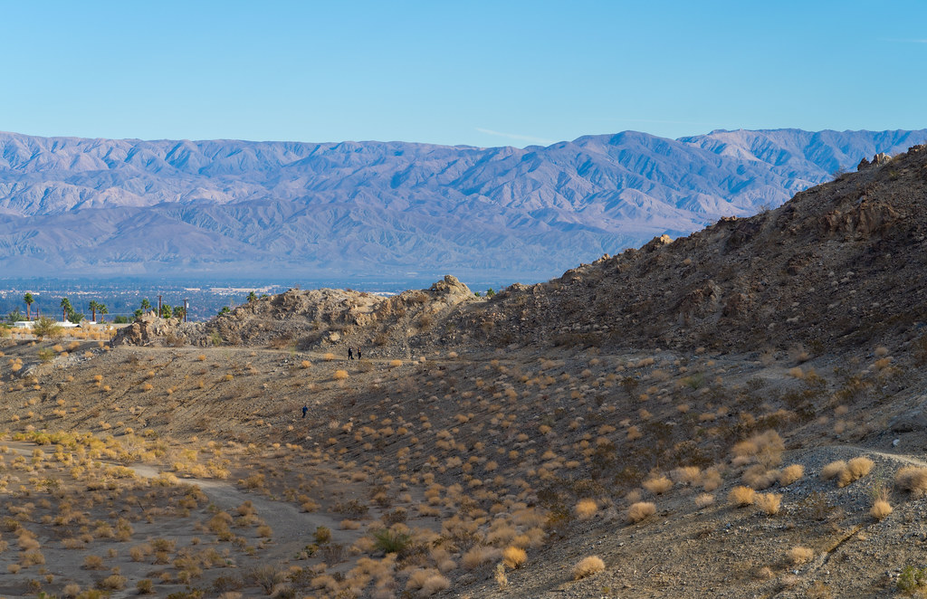
Can you spot the tiny figures at the top of the hill? I’m confident that tiny figures produce a sense of grand scale in images—particular desert shots, like this one, where the inhuman nature of the place can make understanding the sizes of objects difficult. Nonetheless, I find myself wondering how small the figures in an image can be before the viewer loses the ability to recognize them as human.

Coachella Valley is a desert that was once home to a lake, so careful management of water—both where it should go, and where it shouldn’t—leads to some fascinating human-engineered structures. I like this image for the sense of depth, but also for the way that the unmodified hills rise above the human-produced forms in the fore- and mid-ground.
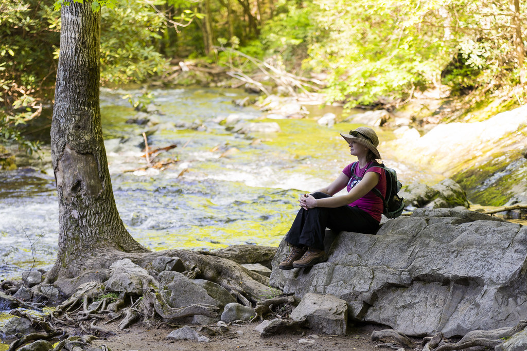
A poster of Caspar David Friedrich’s “Wanderer above the Sea of Fog” hung above my bed in college, and I’ve since then developed a love of Rückenfiguren in images. Building from my last post’s theme of self-portraiture, I thought using myself as the POV for an image in Stone Valley might add the right German Romantic vibe.
An afternoon of hiking merits a rest in the shade before returning to town for schnitzel.