Good landscape photography advice: take your pictures from the top of the second tallest structure (or drone) around and let the tallest structure (like St. Lawrence’s Gunnison Chapel) cross the horizon.


HDR Photography
Good landscape photography advice: take your pictures from the top of the second tallest structure (or drone) around and let the tallest structure (like St. Lawrence’s Gunnison Chapel) cross the horizon.
High above the wet woods of northern Vermont in early winter, the contrast between dark coniferous trees and blanched deciduous trees makes for a mottled appearance. Down amongst that Ising Model of tree distribution, a little building or two make for odd inhomogeneities.
I’ve previously compared the feel of St. Lawrence University’s campus in the winter to a ski resort missing its ski slopes; even from the air, the miniature snow city effect holds. Though I’m not sure I can explain the particular magic of this image, it currently holds the record has the most-liked picture on St. Lawrence’s Instagram. Perhaps it’s the glow of the setting sun on the buildings?
Even from high above, the evidence of winter’s arrival show in the locked-down and cracked-apart landscape of the northeastern United States.
Finals week is upon St. Lawrence University. The campus is in full “winter mode”, blanketed with snow. The oddest thing about this time is its effect on the student population: a sharp partitioning between those who are finished, relaxed, preparing to leave and those who are tense, stressed, and trying to make it through. Like the dynamics of molecules in excited states, that latter group slowly relaxes to join the former.
A family farm on a hillside in northern Vermont at the start of winter is like an empty table, ready to be set for a meal. These and other folksy aphorisms, brought to you by a digital eye on a flying robot stabilized by orbiting artificial satellites and electronic gyroscopes. The future is excellent!
The aerial view can help to put the day-to-day challenges of life in perspective. Nothing looks quite so huge from up here.
From a quadcopter-eye’s view of Johnson Hall, the effects of this season’s abnormal weather are on full display. Instead of “oranges and golds,” the North Country landscape has reached an odd “green trees and bare sticks” mix. This rogue maple is fighting the good fight for fall!
Arriving at St. Lawrence’s campus, I was amazed at all of the space between the buildings: tree-lined paths, broad quads, and extra fields. Having spent my education on urban campuses with buildings packed in tightly together, I was used to a height and compact structure.
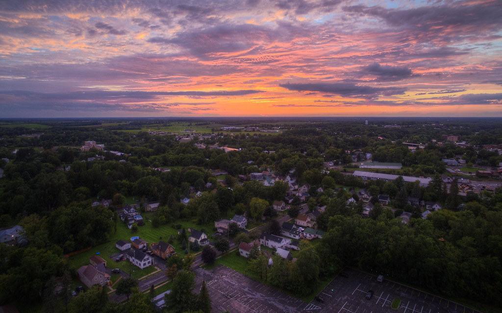
Small-town America seems even smaller in the face of an epic sunset and the thunderstorm it presaged.
In the past, I’ve photographed several Japanese gardens, and even St. Lawrence University’s own North Country Japanese Garden, but I’ve never been able to capture it like this before. From my quadcopter’s vantage point, I captured the geometry of Sykes Hall and the North Country Japanese Garden in the grids of streets and campus paths.
Though St. Lawrence has its share of modern buildings (including my own), it’s the old part of campus (buildings like Piskor and Sykes Halls) that best captures the Harry Potter vibe of small liberal arts colleges in the Northeast.
There’s spectacular luck involved in a tornado-warning-inducing storm abates just as sunset begins, leaving a rugged magenta sky in its wake. (Plus, I can’t fly the quadcopter in the rain.)
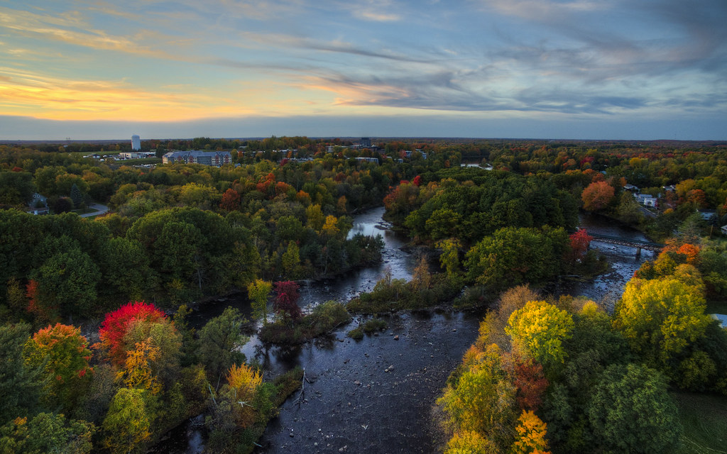
Autumn is my favorite season for flying above the North Country. Heading back toward New York, there’s a lot to look forward to with the shift in the seasons.
Canton’s bars are pretty specific in their target markets: bars for students, or for locals, or for the staff of the local schools. There’s not a lot of overlap. The Buccaneer Lounge, housed in the blue and white building at the lower right of today’s quadcopter photo, was the favorite hangout of faculty. The bar closed this winter, and (as with many third spaces) it will be missed.