For something termed a “hazard,” this body of water looks pretty placid in the evening light.


HDR Photography
For something termed a “hazard,” this body of water looks pretty placid in the evening light.
“Coachella Valley was just battered by Hurricane Hilary.” — What an odd sentence to write. Today, we’re looking back to times when the idea of this dry lake bed being hit by a hurricane sounded like science fiction.


 ]
]
Rather than a fortress in a forest, this is a fortress composed of forest—or at least, it feels that way. While the far-off mountains and the lights of Palm Springs may be visible from the air, the ground-level setting is far more constrained and cozy.

P.S. Can you spot your humble photographer in this shot?
Holiday gatherings with palms in place of pines are out of the ordinary to this northeasterner, but the strangest modification remains the outdoor dining.

Warm morning light on palm fronds and mountain faces, placid reflections in the water hazards: I’m not much of a golfer, but images like this one help me to understand the appeal.

Though a photographer might briefly visit many locations, actually staying in a location means being present at the moment when the light is just right. In this case, sunrise pouring into Coachella Valley lights up the mountainsides and the rooftops, but not yet the valley floor itself.

Being there to capture the sunrise picture is great, of course, but being on location in this case also meant being able to follow it up with a sunrise dip in the hot tub.

The dry seabed that is Coachella Valley provides a very flat surface for construction; as a result, modern constructions mostly fall on whatever pattern/array is convenient to the developers. In a few places, however, interruptions in those arrays stand out in an aerial view.
The palms on this golf course, for example, are on a clear grid, with the fairways and greens cut into it. Was this a palm plantation before the course was build?

Here, the green lawn of a larger home stands out, covering multiple grid positions, while neighboring homes cluster into smaller, more regularly arrayed lots.

Though this subdivision isn’t itself on a grid, the clubhouse nonetheless interrupts the pattern.

A big, broad, western-America sunrise may feel summer-y, but this one was taken in the depths of winter.

An early-morning flight out of Palm Springs airport paints gentle hues onto the massive wall that is Mt. San Jacinto. The orderly, be-palm-tree’d grid of the valley floor runs so sharply into the mountainside that I was immediately reminded that a sea once occupied the valley.

Rain brings spontaneous desert symmetry breaking: some areas become rivers and streams, while others stay high and dry. La Quinta Cove brings hiking trails into this equation. Looking high over the landscape, those trails and dry streambeds may be hard to distinguish—until the rain comes. In the distance, just above the tan tanks on the left of the image, the Salton Sea serves as a reminder of how water and the desert interact.

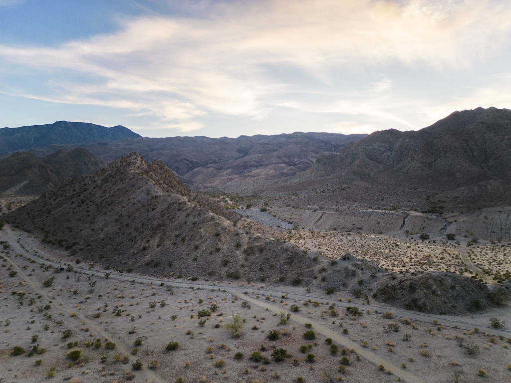
Mountains and hillsides in Coachella Valley are a rocky, scrubby desert so long as they stay sufficiently sloped; the moment they reach the flat ex-lake valley floor, the housing developments begin.

The path at right is a fairly treacherous, dusty way up to the top of this hill; it’s the one I took last year to capture images like this one. Flying to the top with my drone is, by comparison, a bit less strenuous.

My trips to this hill last year were constrained by the limitations of gravity; bringing my drone with me this year opened up whole new vistas and geometries. The artificial nature of this water retention area is far more apparent when view from the air.
Like a child’s legos, spilled out onto the floor until they reach the wall of the room, the sprawl of Coachella Valley reaches from one mountain range to the other.
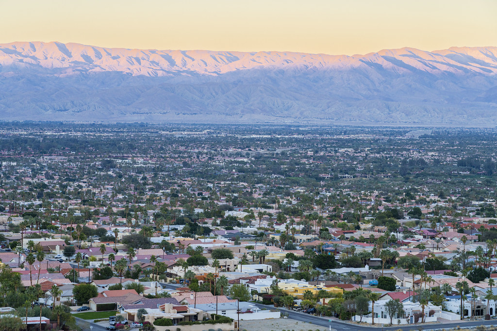
Of course, when that sprawl does reach the edge, modern California’s land conservation kicks in and a hard barrier appears between homes and desert.

Today marks the start of the spring semester at many colleges and universities. A wistful look back at winter break and its associated festivities seemed appropriate.

