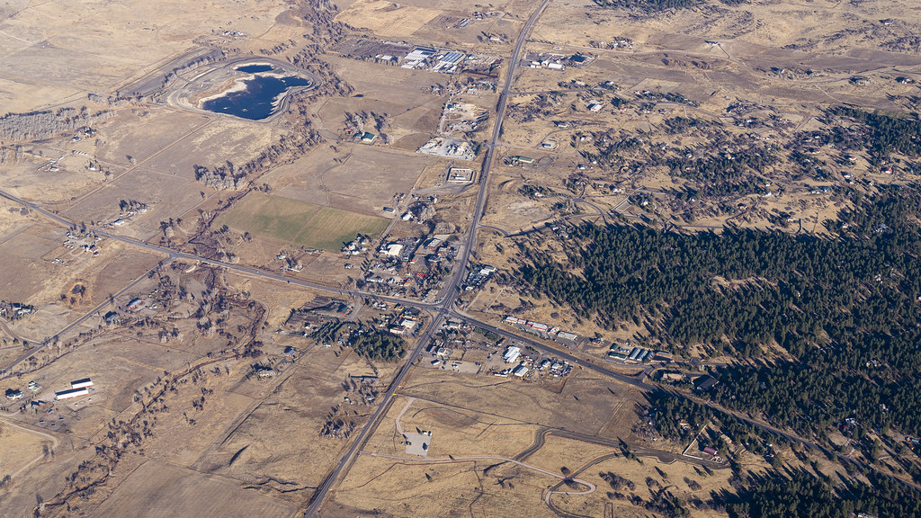
Just as any sufficiently advanced technology is indistinguishable from magic, I likewise suspect that any sufficiently populated crossroads is indistinguishable from a town.

HDR Photography
Just as any sufficiently advanced technology is indistinguishable from magic, I likewise suspect that any sufficiently populated crossroads is indistinguishable from a town.
Sections of Chicago’s hinterlands that were once stockyards and meatpacking facilities have long since been converted to serve as industrial parks, but the sense of an endless grid remains.

Neal Stephenson’s “burbclaves” in Snow Crash are subdivisions-as-mini-nation-states—an intentionally silly idea in the satirical context of the novel’s libertarian dystopia. These Denver suburbs are now my internal vision of how such a burbclave would look.

Waaay off in the distance, beyond the un-grid of this subdivision, is downtown Denver. Beyond that are the Rocky Mountains. That sense of being sort-of-near spectacular sights while still being trapped within cul-de-sacs is one that I expect is pretty common to people who spent some amount of their childhood living within such developments.

Dune’s naturally occurring “Shield Wall” always seemed a bit fictional to me—until I saw Denver’s metropolitan area from above. Look at that sharp divide between mountains and the valley floor!

I’ve shown you a far different view of the wind farms at the northern end of Coachella Valley, but an aerial view at dawn provides better documentation of the project’s true scale, and its place in the fascinating geological setting of the valley.

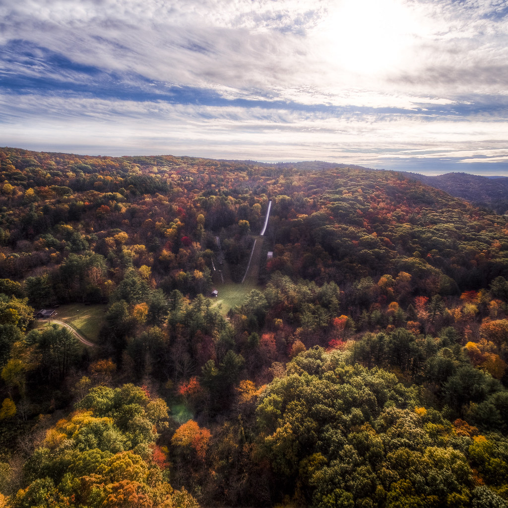
Bright Saturday morning sunshine warms Salisbury, Connecticut and make the town ski jump flash in the distance at the left of the image.

Neal Stephenson’s “Fall” suggests that that pattern of one’s childhood hometown is patterned deeply into the brain. This picture captures pretty much everywhere I could get to on my own (i.e., on my bike) when I was seven years old—so, basically my whole world at that point.

Beneath the mountain-wall around Denver, the only bright objects are the artificial lights and the highly reflective bodies of water.

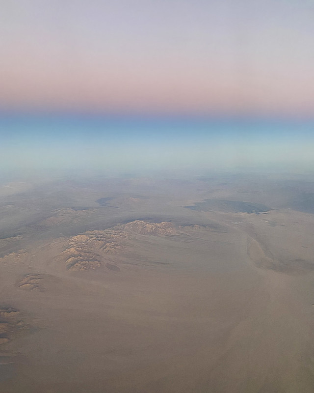
High above the desert of southeastern California, the expanses of sand and stone look more to me like the surface of Mars than anywhere on this planet.
Add a mile or so above the Mile High City and the sunset views are spectacular, even on clear winter nights.

This particular acute crossroads in Salisbury, Connecticut is home to the White Hart Inn, and it turns out that it’s photogenic in just about every season.

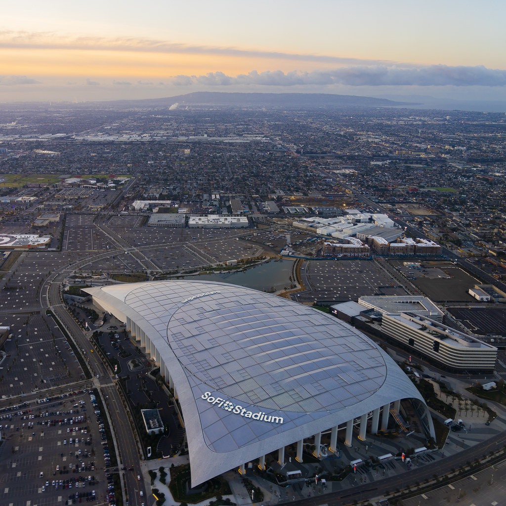
Sunrise over Los Angeles and SoFi Stadium; time to say goodbye to 2021. See you in the new year!
As a child, I dreamed of flying over my home town—viewing all of the familiar paths from high above. Visiting that town last weekend, I was able to photographically make that dream a reality. The forests where I hiked and the town ski jump are all laid out before the drone’s lens.
Amongst the Thousand Islands, scattered between New York and Ontario, this island of fields and wind turbines seems to be astride the past and the future.

