Autumn went by quickly this year; the thermodynamic realities outside my door make clear that the adaptations of the North Country trees aren’t coming any too soon.


HDR Photography
Autumn went by quickly this year; the thermodynamic realities outside my door make clear that the adaptations of the North Country trees aren’t coming any too soon.
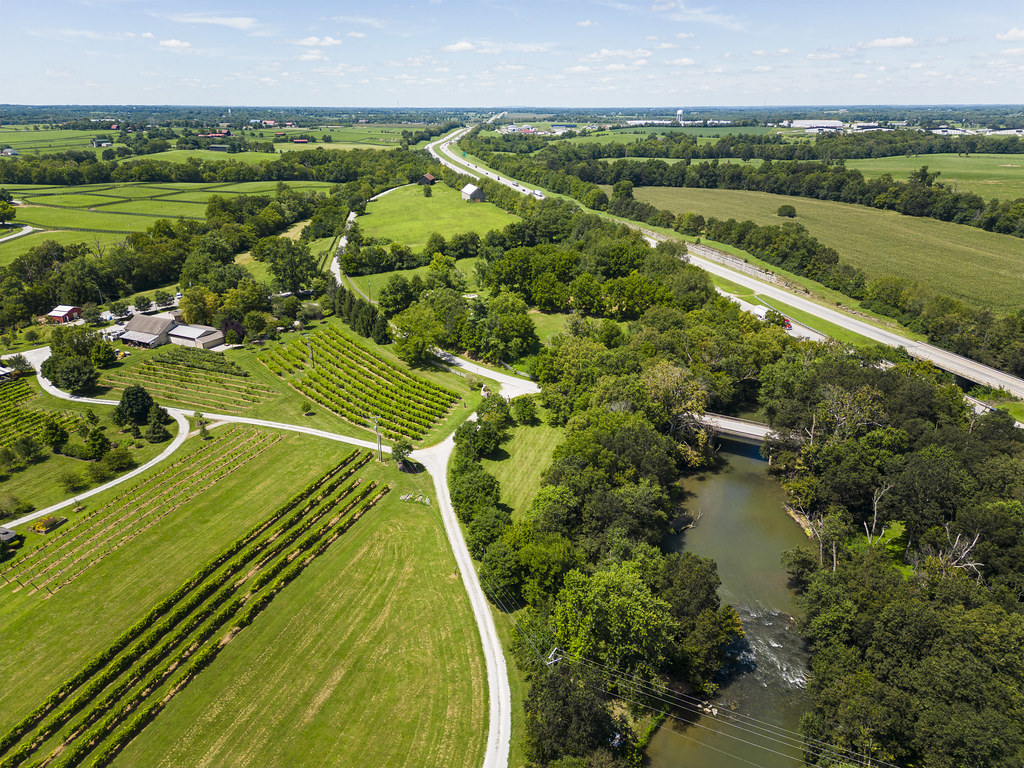
The bucolic setting of Equus Run is so charming and quaint (and well-shielded by trees and hillside) that I can easily forget the Interstate runnin’ through the yard.
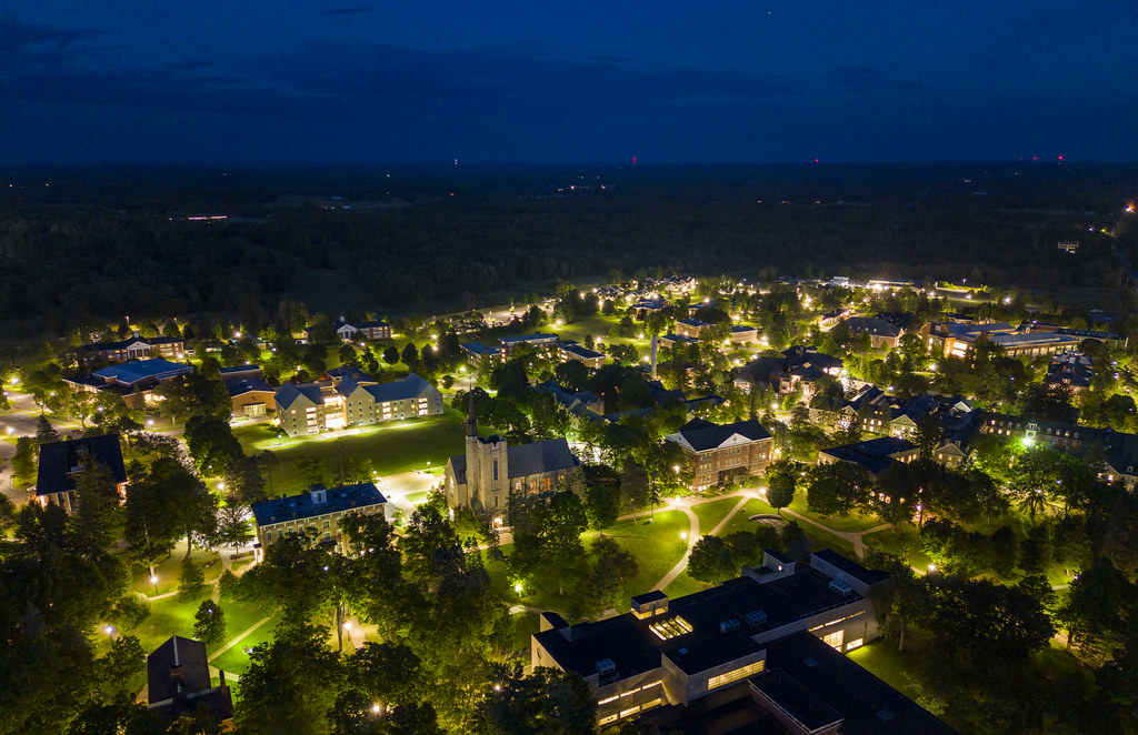
Park Street might have been named for a different park (the one up the street), but the glow of St. Lawrence’s campus at night (the reverse view of this shot) has a delightful Central Park vibe that matches the street name well.

Visiting my colleague’s property at the height of fall foliage, I was impressed by the contemporary solarpunk aesthetic of a solar panel installation in an orchard.

Following principles of green design, St. Lawrence University’s Johnson Hall of Science was built facing north-south, such that light throughout the day could be used to light rooms on both sides. The inner courtyard even features a light stone facade to help bounce more light into the inner offices. (I can attest that this works.) When the rest of the campus was constructed along the local street grid, rather than the compass points, the result is that JHS looks like a bit of a rebel among its neighbors.

One of St. Lawrence’s monikers is “A Candle in the Wilderness,” and this drone shot of the bright campus with the dark forests beyond explains the name.
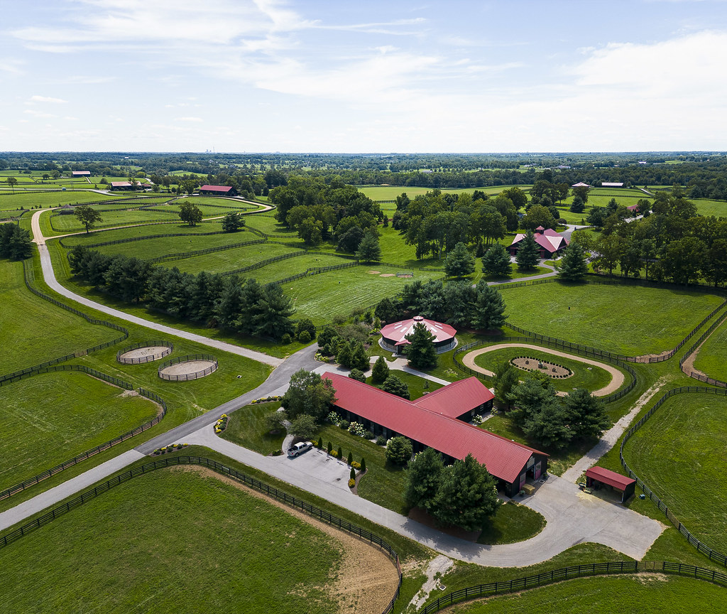
Everything the sun touches is Margaux Farm. This red-roofed barn in the foreground is but one example; look off into the distance and count how many additional structures appear with a matching color scheme.
Over the course of the past few years, Canton’s park fountain has been graciously renovated and restored. The aerial view of the fountain at the lower edge of today’s image is nicely highlighted by the light streaks of passing vehicles.

The expansive grid of warehouses and industrial facilities in what was once Chicago’s meatpacking district have an eerie, cyberpunky regularity. An aggressive teal/magenta color grading maxes out the Matrix/Tron vibes.

If you zoom all the way in, there are tiny goats in the fields between the power lines. They convey a pretty mind-boggling sense of just how big those lines are.

Route 11, the main road connecting the whole North Country (we don’t have any Interstates), runs through a series of quaint downtowns, where it temporarily becomes Main St. The impressive stability of the DJI Mini 3 Pro meant that I could capture long, smooth light trails from headlights and taillights representing the evening’s traffic.

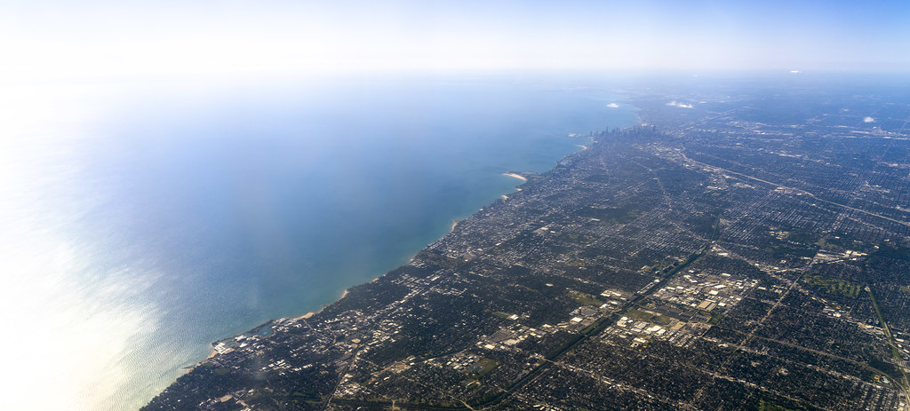
The steady, even grid of Chicago and its suburbs terminates into chaotic reality when it hits the shore of Lake Michigan, but hey—at least there’s a beach.
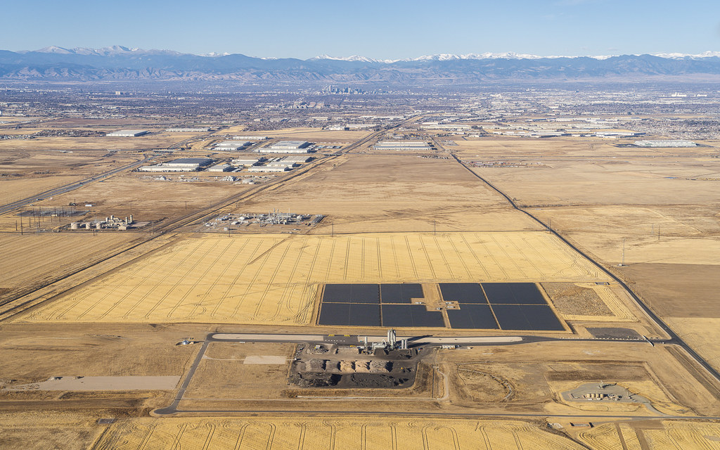
Given that most of my research is focused on renewable energy, I love to pick up relevant pictures to include in my presentations. This solar facility outside Denver, CO, was far larger than an initial glance at the image might imply. The tiny yellow dots at the base of the cylinders in the center of the image are enormous pieces of earthmoving equipment.

I’ll be teaching my first class of the Fall 2022 semester tomorrow morning, so today seemed like the perfect day to reflect on the campus to which I’m returning. The structures amidst the trees sure look good from 100 meters up.

This image also brings up an interesting note on aspect ratios: Since the start of Decaseconds, I’ve largely been formatting my very favorite images in a 1.6:1 (i.e., 16:10) aspect ratio, such that they’d function well as desktops for my various MacBook Pro laptops. The advent of the “notch” and associated added screen real estate means that new MBPs have a 1.547:1 ratio—and thus my favorite images (like this one) are arriving with a new aspect ratio.
My favorite feature to capture in landscape images is a gradient from sparsely populated areas to dense, urban ones. A connecting flight through Denver gave me the opportunity to add a mile-high gradient to my collection.
This picture was processed using the Super Resolution algorithm, so it’s definitely worth clicking through to view the high-resolution version on flickr.
