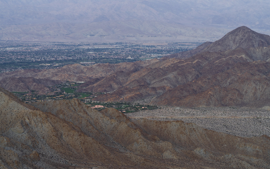
Though the tiny lights of the Coachella Valley set the scale for the mighty size of the San Jacinto Mountains, even that range is dwarfed by the mighty scope and expanse of the sunset.


HDR Photography
Though the tiny lights of the Coachella Valley set the scale for the mighty size of the San Jacinto Mountains, even that range is dwarfed by the mighty scope and expanse of the sunset.
After our redeye flight from Madrid to New York turned around halfway over the Atlantic due to mechanical issues, I’ve never been so happy to see sunrise on dry land.

In the rainy hills above Palm Springs, I was able to put the techniques I learned at #GRIDLIFE last fall to good use to get a dramatic shot of a Challenger driving faster than was probably advisable on the rainy road to San Diego.

A work truck heading into a rainy desert valley whisper tales of a working-classic California life that gets glossed over in many depictions of Coachella Valley.

Though a photographer might briefly visit many locations, actually staying in a location means being present at the moment when the light is just right. In this case, sunrise pouring into Coachella Valley lights up the mountainsides and the rooftops, but not yet the valley floor itself.

Being there to capture the sunrise picture is great, of course, but being on location in this case also meant being able to follow it up with a sunrise dip in the hot tub.

The dry seabed that is Coachella Valley provides a very flat surface for construction; as a result, modern constructions mostly fall on whatever pattern/array is convenient to the developers. In a few places, however, interruptions in those arrays stand out in an aerial view.
The palms on this golf course, for example, are on a clear grid, with the fairways and greens cut into it. Was this a palm plantation before the course was build?

Here, the green lawn of a larger home stands out, covering multiple grid positions, while neighboring homes cluster into smaller, more regularly arrayed lots.

Though this subdivision isn’t itself on a grid, the clubhouse nonetheless interrupts the pattern.

Dune’s naturally occurring “Shield Wall” always seemed a bit fictional to me—until I saw Denver’s metropolitan area from above. Look at that sharp divide between mountains and the valley floor!

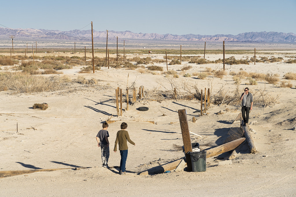
On the one hand, from the perspective of a young boy, I can see why exploring Bombay Beach would be just about the coolest thing ever. On the other hand, from the perspective of an adult, the view of a father smoking while his kids play in the post-apocalyptic hellscape of the Salton Sea is hilarious.
If ever a reminder was needed that large swaths of Coachella Valley would prefer to be desert, the stark shift that occurs at the border where artificial watering stops provides one.
A different kind of Rückensfiguren from my last post: Teenagers visiting a memorial along the curving roads of the Pines to Palms Highway, far above the desert of Coachella Valley.

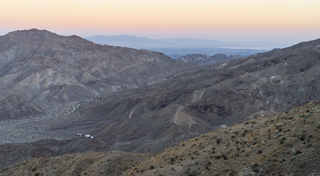
While Coachella Valley is being aggressively developed, there are areas—around the edges, or in the expanse of the Salton Sea—where reminders of nature’s true intentions for the area are unavoidable.
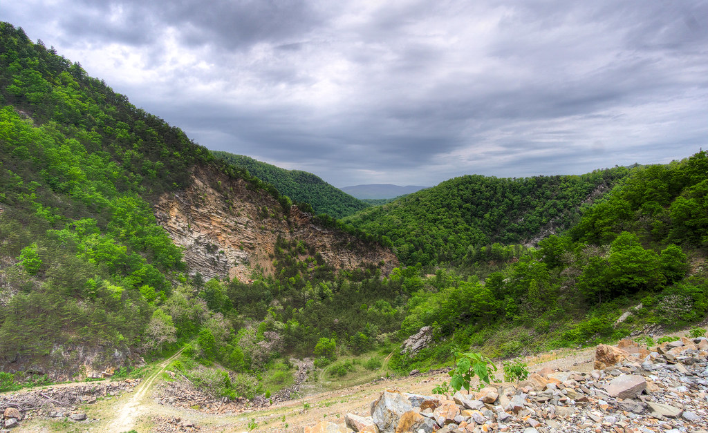
Contemplating a drive back across North America, I’m most looking forward to the West. The mildly populated areas (look at the tiny path in the distant center of the image) remind me of the best parts of Sergio Leone’s Spaghetti Westerns.

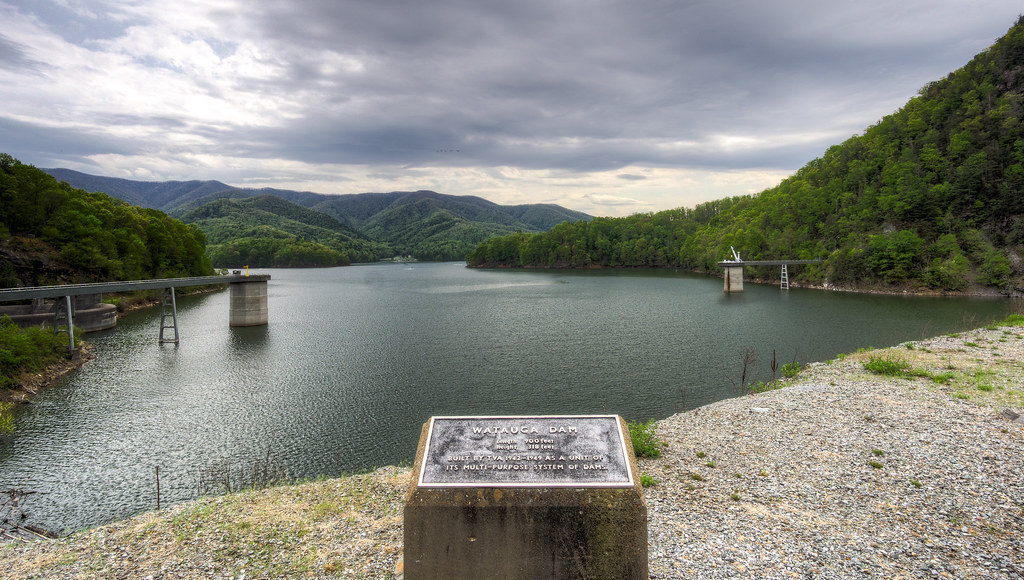
It’s hard to tell from looking at the lake, even with the plaque in front of you, just how massive the Watauga Dam is… until you turn around. It’s actually pretty disorienting to look at what looks like a normal lake, then turn around and see the valley that the lake used to be. And when you look down the slope at the valley floor below you really start to understand how deep the lake really is.
Once you venture even a few miles from the suburban world of the East Bay into the hills surrounding, all sorts of weird little “model train set” vistas appear. On a rainy, gloomy day, with low cloud cover penning in the view, you could almost be forgiven for thinking you’d stumbled into a giant’s basement hobby space.

