Though much of the country is enjoying crispy fall weather, the mountains and hills of the northeast have already been carpeted with the first snowfalls, and much of the bright foliage has already fallen to the forest floor.

HDR Photography
Though much of the country is enjoying crispy fall weather, the mountains and hills of the northeast have already been carpeted with the first snowfalls, and much of the bright foliage has already fallen to the forest floor.
Lampson Falls cuts through the woods where the St. Lawrence River Valley begins to transition into the Adirondacks. On this crisp fall afternoon, perfect weather accompanied the hikers exploring the groomed trails, campsites, and beach surrounding the falls.

Above a northern forest in the fall, the burst of foliage almost becomes an abstract explosion. Winding down on the forest floor is a neatly groomed path, adding just a tiny extra hint of possibility.
St. Lawrence University’s Sustainability Program hosted a Harvest Fest at their farm this weekend, and I was on hand with the drone to get images of the day. The farm in the distance will be the upcoming topic of the next few posts covering events of the day.

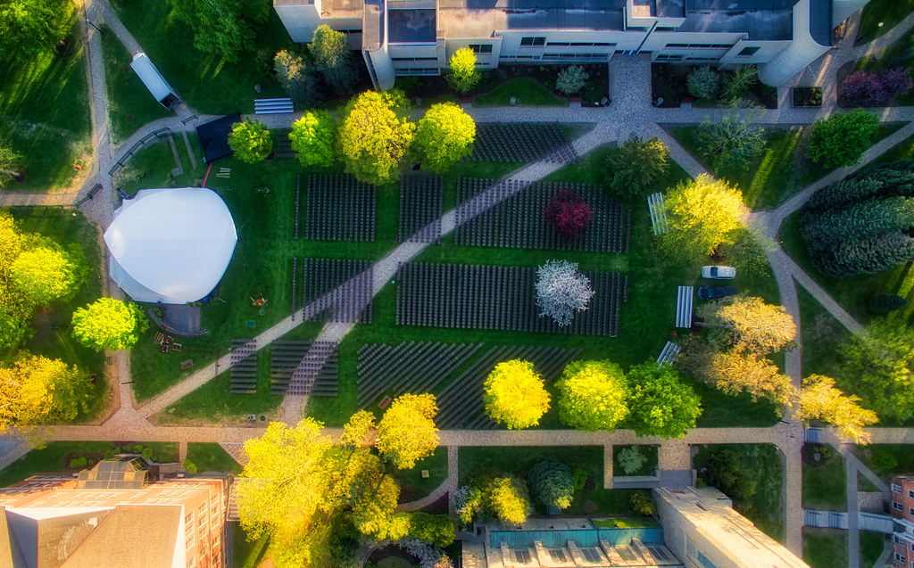
The quad between St. Lawrence University’s Gunnison Memorial Chapel and Kirk Douglas Hall is a center of activity after 4:00. That also often coincides with the drone photographer’s favorite moment when only the treetops remain bright, while the pathways and grassy places fall into cool shadows.
Rows and rows and rows of folding chairs bookend the school year: once in the fall for matriculation, and once in the spring for commencement. Their symmetry overlaps the now-permanent paths that once began as desire paths across the quad.
In the foreground, the Hoot Owl bar sits near Canton’s railroad tracks. Though it used to be the train station, it’s now one of the main student bars. I like to think of it as the guard house between town and the domain of the undergraduates.

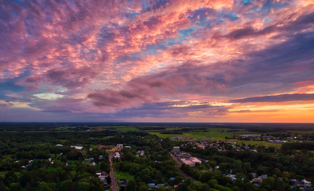
Where sunset tapers into the rest of the sky—or when a sunset is so complete and overwhelming that the whole sky is transformed—there are interesting patterns to be found in the northwestern and southwestern edge. The evening of this image over Canton, New York, the result seemed particularly reminiscent of some Renaissance painting.
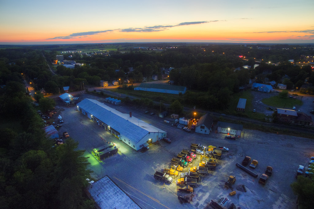
Yesterday, a Canton native unironically told me, “Winter is coming.” When it arrives, the town works team will deploy from this location to tackle snow with special forces precision. Northern New York does not mess around.
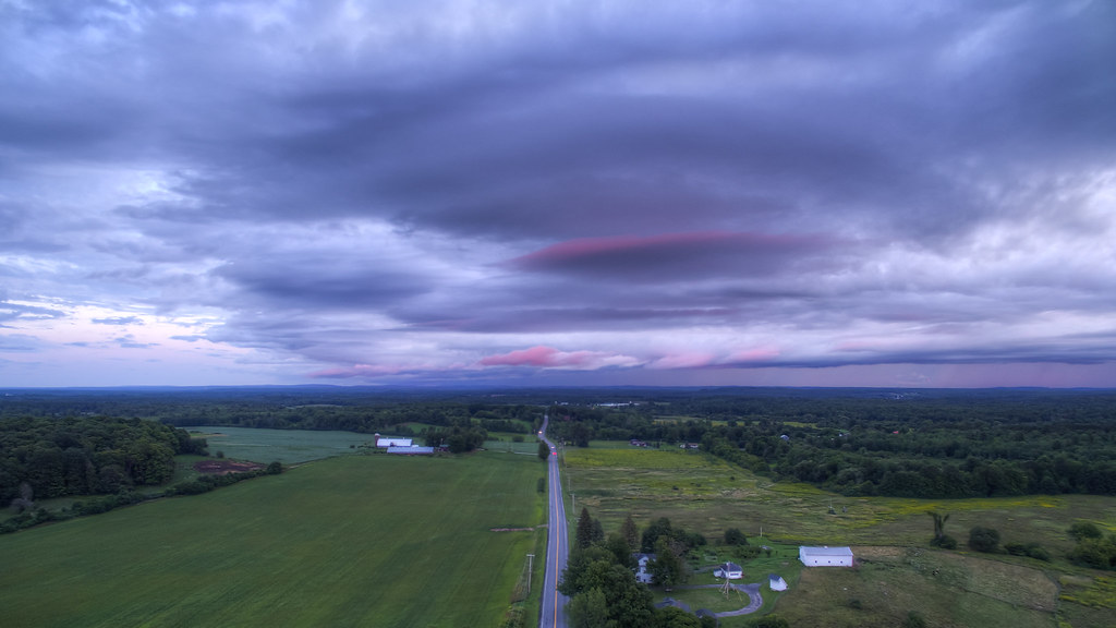
After a day of rain, the clouds peeled back around sunset to reveal the foothills of the Adirondacks to the south. This bucolic landscape (on the right side of the image) is actually the eastern reach of St. Lawrence University’s 1,000-acre campus.
In the foothills of the Adirondacks, the Raquette River was dammed for hydroelectric power. The town of Colton, New York sits on the resulting reservoir; the rapids in the foreground are the beginning of Stone Valley, an area of trails that I’ve photographed extensively in the past. The contrast between placid reflections in the reservoir and the dark currents of the river proper stand out during the blue hour.
Heavy traffic isn’t restricted to city centers! This summer, Canton’s bridge over the Grasse river is being repaired, cutting it from four lanes to two. Around 8:00, 12:00, and 4:00, traffic backs up for half a mile down Main Street. (But I’d rather the traffic than skipping the bridge repairs…)

Soft evening light scattering through the trees of town brings out a dreamlike quality in Canton. Though it may be filled with humans, my imagination adds in a few nymphs, wood elves, pixies, and miscellaneous spirits.
This quad isn’t very much of a quardrangle, from a geometric standpoint, but that doesn’t stop students and visiting campers from having an absolutely delightful afternoon there.
I’ve often commented to curious colleagues that the benefit of drone photography is the ability to get images from that “impossible” space: lower than a helicopter or other light aircraft might dare fly, but higher than a photographer could reach with a cherry picker. Those are views that can only be had from building height, and so a drone let’s one (metaphorically) put a temporary building wherever they’d like, at least for photographic purposes.
I’m evidently not obeying that rule here, nearly 400 feet above St. Lawrence University’s sylvan campus. It’s from this height where the taper of from larger halls down to smaller dorms and townhouses, and then ultimately to wooded space at the eastern edge of campus, is visible.