Today’s image comes from along the same trajectory as my Cantonhenge shot, but farther down the path of Route 11. In the foreground, parks, businesses, and homes cluster around the center of Canton, New York.


HDR Photography
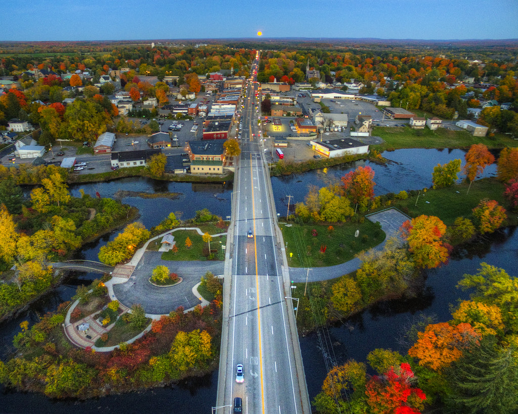
Today’s image comes from along the same trajectory as my Cantonhenge shot, but farther down the path of Route 11. In the foreground, parks, businesses, and homes cluster around the center of Canton, New York.
Today’s image falls into the category “How have I not posted this already?” This image of a supermoon aligning with the Route 11 principal axis of Canton, New York has been used in the table of contents of St. Lawrence University’s magazine, as well as in several blog posts. In spite of that, I’ve apparently (according to Flickr’s camera roll feature) never shared it to Decaseconds.
Strip shopping centers, golf courses, and a Best Western: this stretch of NY Rt. 11 outside Canton differs little from other blocks of America. Still, this road is special… The North Country lacks an interstates whatsoever, so this two-lane blacktop is the only major path through the region. Though the general west-southwest direction of the road wavers little, this particular intersection is a place where it temporarily swings north to pass through town.

